
Path to Tatsfield Church
Introduction
The photograph on this page of Path to Tatsfield Church by Sean Davis as part of the Geograph project.
The Geograph project started in 2005 with the aim of publishing, organising and preserving representative images for every square kilometre of Great Britain, Ireland and the Isle of Man.

There are currently over 7.5m images from over 14,400 individuals and you can help contribute to the project by visiting https://www.geograph.org.uk
Path to Tatsfield Church
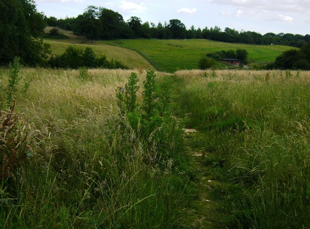
Image: © Sean Davis Taken: 7 Jul 2007
This path leads from Westmore Green at Tatsfield to the local church, which is half a mile away from the village. The village is perched on top of the North Downs in a small corner of Surrey with Biggin Hill and London to the north and bounded by Kent to the east. At 790ft above sea-level, it claims to be the highest village in Surrey and it is said its inhabitants saw London burn in 1666. In more recent times, during periods of extreme snowfall, the village has been completely cut off and had to rely on food parcels being dropped from the air. St Mary's Church dates mainly from the 11th & 13th Centuries. It is Grade 2 listed. The exact date of the church is unknown and although it is not mentioned in the Domesday Book of 1086, St Mary's decided to celebrate its 900th birthday in 1975. For many years the church has played host to a dual congregation of Anglicans and Roman Catholics. In the church graveyard there is an ancient yew, and on the tombstone of Timothy Burgess (died 1876) a novel inscription reads: "Once I stood as you do now, And gaz'd over them as you do now, And you will be as I do now, While others thus look down on thee." The church, the path and Westmore Green is on the route of the London Green Belt Way and the Tandridge Border Path.
Images are licensed for reuse under creativecommons.org/licenses/by-sa/2.0
Image Location

Latitude
51.292231
Longitude
0.025641