Old Milestone in Alexandra Road, St Austell
Introduction
The photograph on this page of Old Milestone in Alexandra Road, St Austell by Rosy Hanns as part of the Geograph project.
The Geograph project started in 2005 with the aim of publishing, organising and preserving representative images for every square kilometre of Great Britain, Ireland and the Isle of Man.

There are currently over 7.5m images from over 14,400 individuals and you can help contribute to the project by visiting https://www.geograph.org.uk
Old Milestone in Alexandra Road, St Austell
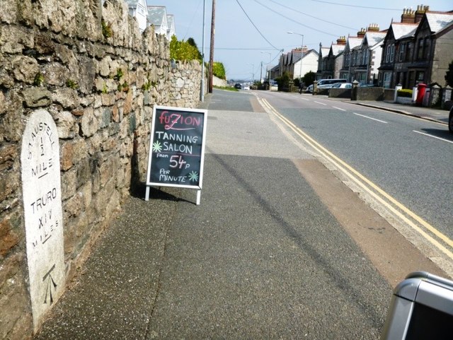
Image: © Rosy Hanns Taken: 13 Apr 2019
Carved stone post by the former A390, in parish of ST AUSTELL (RESTORMEL District), Alexandra Road, by No 10, built into garden wall, on North side of road. Erected by the St Austell & Lostwithiel turnpike trust in the 19th century. Inscription reads:- Sᵀ.AUSTELL ½ --- MILE TRURO XIV MILES --- Large benchmark at base of front face. Grade II listed. List Entry Number: 1407574 https://historicengland.org.uk/listing/the-list/list-entry/1407574 Milestone Society National ID: CW_TOSA14.
Images are licensed for reuse under creativecommons.org/licenses/by-sa/2.0
Image Location
Latitude
50.338074
Longitude
-4.786056