Old Boundary Marker
Introduction
The photograph on this page of Old Boundary Marker by R Hanns as part of the Geograph project.
The Geograph project started in 2005 with the aim of publishing, organising and preserving representative images for every square kilometre of Great Britain, Ireland and the Isle of Man.

There are currently over 7.5m images from over 14,400 individuals and you can help contribute to the project by visiting https://www.geograph.org.uk
Old Boundary Marker
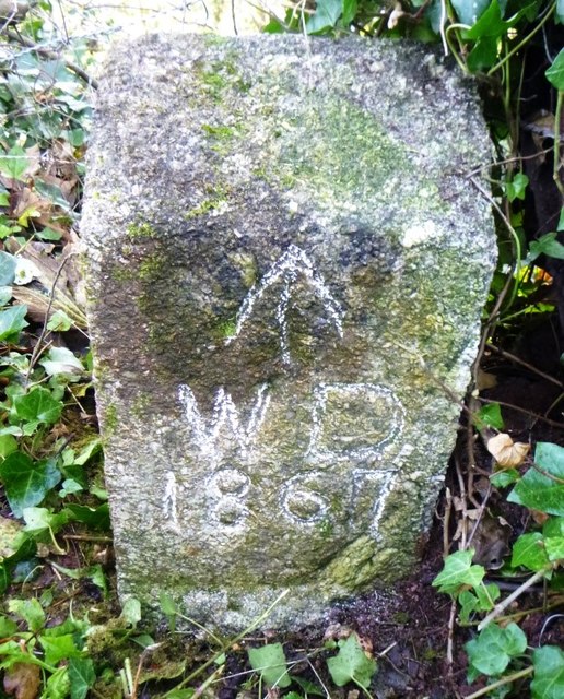
Image: © R Hanns Taken: 27 Oct 2019
War Department Boundary Marker on the east slope of Wringford Down to the north west of Cawsand Fort. MAKER WITH RAME parish. Inscribed ↑ / W D / 1867. The marker is on the boundary of the former Cawsand Fort. Milestone Society National ID: CW_WDCAW02em
Images are licensed for reuse under creativecommons.org/licenses/by-sa/2.0
Image Location
Latitude
50.333299
Longitude
-4.203665