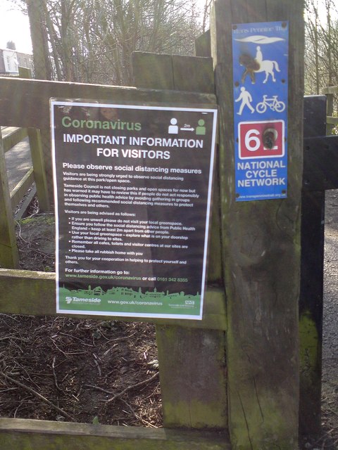
Coronavirus information (Trans Pennine Trail)
Introduction
The photograph on this page of Coronavirus information (Trans Pennine Trail) by Gerald England as part of the Geograph project.
The Geograph project started in 2005 with the aim of publishing, organising and preserving representative images for every square kilometre of Great Britain, Ireland and the Isle of Man.
There are currently over 7.5m images from over 14,400 individuals and you can help contribute to the project by visiting https://www.geograph.org.uk

Image: © Gerald England Taken: 26 Mar 2020
At the entrance to the Trans Pennine Trail and National Cycle Route #62 off Osborne Road Image is a notice which reads: IMPORTANT INFORMATION FOR VISITORS Please observe social distancing measures Visitors are being strongly urged to observe social distancing guidance at this park/open space . Tameside Council is not closing parks and open spaces for now but has warned it may have to review this if people do not act responsibly in observing public health advice by avoiding gathering in groups and following recommended social distancing measures to protect themselves and others. Visitors are being advised as follows: • If you are unwell please do not visit your local greenspace, • Ensure you follow the social distancing advice from Public Health England - keep at least 2m apart from other people. • Use your local greenspace - explore what is on your doorstep rather than driving to sites. • Remember all cafes, toilets and visitor centres at our sites are closed. • Please take all rubbish home with you Thank you for your cooperation in helping to protect yourself and others.

