Bridleway past Dockwell Farm
Introduction
The photograph on this page of Bridleway past Dockwell Farm by Derek Harper as part of the Geograph project.
The Geograph project started in 2005 with the aim of publishing, organising and preserving representative images for every square kilometre of Great Britain, Ireland and the Isle of Man.

There are currently over 7.5m images from over 14,400 individuals and you can help contribute to the project by visiting https://www.geograph.org.uk
Bridleway past Dockwell Farm
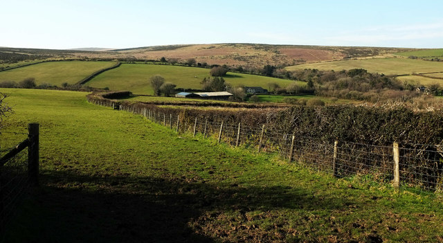
Image: © Derek Harper Taken: 22 Mar 2020
South Brent bridleway 28 heads along the side of the field, formerly an enclosed stroll for livestock (field boundaries have been removed). Dockwell Farm (in Image) occupies a side valley of the Harbourne valley on the right. In the centre background is access land on the open moor, which the bridleway leads to.
Images are licensed for reuse under creativecommons.org/licenses/by-sa/2.0
Image Location
Latitude
50.45509
Longitude
-3.832649