
Moated site of Newhall Grange, north of Northgate and West Pinchbeck: aerial 2020 (2)
Introduction
The photograph on this page of Moated site of Newhall Grange, north of Northgate and West Pinchbeck: aerial 2020 (2) by Simon Tomson as part of the Geograph project.
The Geograph project started in 2005 with the aim of publishing, organising and preserving representative images for every square kilometre of Great Britain, Ireland and the Isle of Man.

There are currently over 7.5m images from over 14,400 individuals and you can help contribute to the project by visiting https://www.geograph.org.uk
Moated site of Newhall Grange, north of Northgate and West Pinchbeck: aerial 2020 (2)
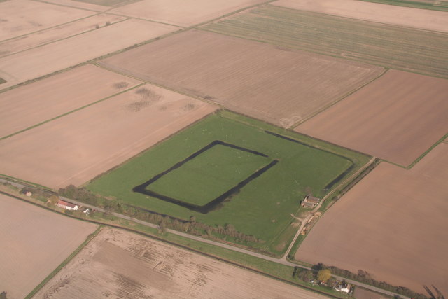
Image: © Simon Tomson Taken: 22 Mar 2020
Seen here after prologed rain. See http://www.pastscape.org.uk/hob.aspx?hob_id=350560&sort=2&rational=m& South of Rigbolt House. See https://historicengland.org.uk/listing/the-list/list-entry/1009981 and https://www.pastscape.org.uk/hob.aspx?hob_id=350560&sort=2&rational=m&recordsperpage=10&maplat=52.82736965&maplong=-0.22542798&mapisa=1000&mapist=os&mapilo=-0.2254&mapila=52.8274&mapiloe=w&mapilan=n&mapios=TF195270&mapigrn=327050&mapigre=519550&mapipc=#aRt There are other features within the outer moat. This is described variously as "an extensive Manorial site comprising basically an inner and outer moat" and "identified as Newhall Grange, belonging to Spalding Priory". It is located alongside the medieval Newdyke, now known as Hammond Beck, on marine silts which were probably taken in from the fen in the early 12th century... The relationship of the monument to the adjacent medieval fen bank, and its proximity to another moated site and grange at Rigbolt House, less than 1km to the north in the neighbouring parish of Gosberton, are features of wider interest for the study of the medieval landscape in this part of the Fenland region". See also Image
Images are licensed for reuse under creativecommons.org/licenses/by-sa/2.0
Image Location

Latitude
52.827464
Longitude
-0.227683