Old Boundary Marker
Introduction
The photograph on this page of Old Boundary Marker by R Hanns as part of the Geograph project.
The Geograph project started in 2005 with the aim of publishing, organising and preserving representative images for every square kilometre of Great Britain, Ireland and the Isle of Man.

There are currently over 7.5m images from over 14,400 individuals and you can help contribute to the project by visiting https://www.geograph.org.uk
Old Boundary Marker
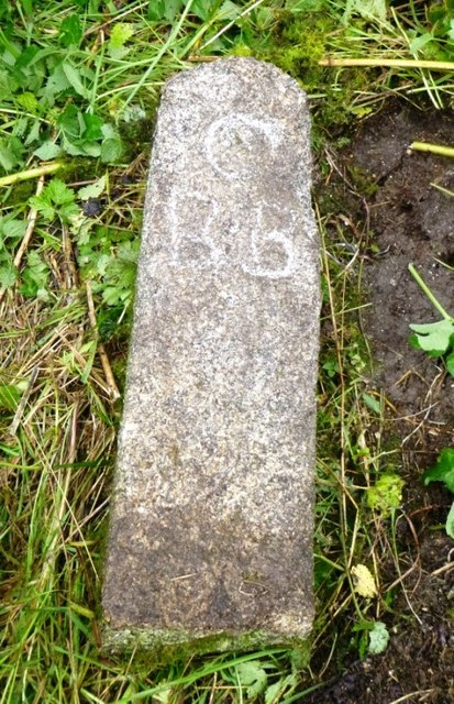
Image: © R Hanns Taken: 12 Sep 2019
Parish Boundary Marker 30 metres to northeast of a sewage works, with a part broken off and lying on the ground in an area of rough grass and brambles. CAMELFORD parish. Inscribed C / B.B (possibly standing for Camelford Borough bounds). Grade II Listed https://historicengland.org.uk/listing/the-list/list-entry/1328094. Milestone Society National ID: CW_CAMEL04pb
Images are licensed for reuse under creativecommons.org/licenses/by-sa/2.0
Image Location


Leaflet Map data © OpenStreetMap
Latitude
50.619234
Longitude
-4.678723