Old Boundary Marker
Introduction
The photograph on this page of Old Boundary Marker by R Hanns as part of the Geograph project.
The Geograph project started in 2005 with the aim of publishing, organising and preserving representative images for every square kilometre of Great Britain, Ireland and the Isle of Man.

There are currently over 7.5m images from over 14,400 individuals and you can help contribute to the project by visiting https://www.geograph.org.uk
Old Boundary Marker
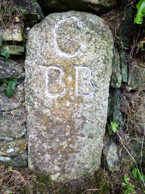
Image: © R Hanns Taken: 25 Aug 2019
Parish Boundary Marker on the A39 at the junction of Victoria Road and Higher Cross Lane, to the right hand side of the entrance to Beech House. CAMELFORD parish. Inscribed C / B.B (possibly standing for Camelford Borough bounds). Grade II Listed https://historicengland.org.uk/listing/the-list/list-entry/1137745. Milestone Society National ID: CW_CAMEL01pb
Images are licensed for reuse under creativecommons.org/licenses/by-sa/2.0
Image Location
Latitude
50.624953
Longitude
-4.67096