20 St Vincent Crescent
Introduction
The photograph on this page of 20 St Vincent Crescent by Richard Sutcliffe as part of the Geograph project.
The Geograph project started in 2005 with the aim of publishing, organising and preserving representative images for every square kilometre of Great Britain, Ireland and the Isle of Man.

There are currently over 7.5m images from over 14,400 individuals and you can help contribute to the project by visiting https://www.geograph.org.uk
20 St Vincent Crescent
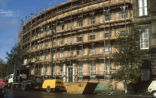
Image: © Richard Sutcliffe Taken: Unknown
Part of a long range of tenements designed by Alexander Kirkland, dating from circa 1855. They are all Category A listed http://portal.historicenvironment.scot/designation/LB33128. The scaffolding was up while the properties were stone cleaned, and essential repairs were undertaken as part of an improvement scheme in 1985.
Images are licensed for reuse under creativecommons.org/licenses/by-sa/2.0
Image Location
Latitude
55.863175
Longitude
-4.283157