Railway & Wraysbury River from Old Cattle Bridge
Introduction
The photograph on this page of Railway & Wraysbury River from Old Cattle Bridge by Sean Davis as part of the Geograph project.
The Geograph project started in 2005 with the aim of publishing, organising and preserving representative images for every square kilometre of Great Britain, Ireland and the Isle of Man.

There are currently over 7.5m images from over 14,400 individuals and you can help contribute to the project by visiting https://www.geograph.org.uk
Railway & Wraysbury River from Old Cattle Bridge
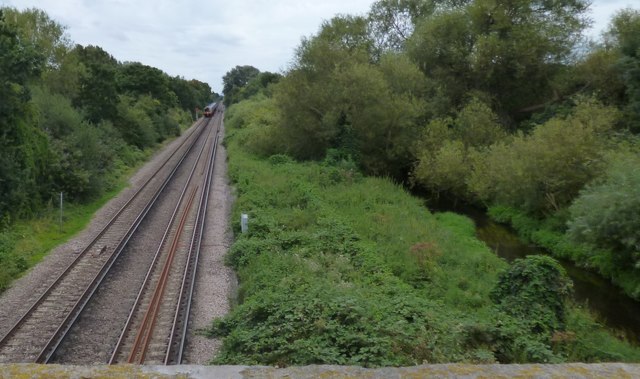
Image: © Sean Davis Taken: 24 Aug 2012
Train on its way from Staines to Windsor & Eton Riverside, taken from the “Cattle Bridge” or "Drover’s Bridge". To the right is the Wraysbury River and hidden by the trees is the now closed Great Western Railway and next to it is Staines Aqueduct. It sounds complicated but the Cattle Bridge consists of three different bridges built between c1840 and 1885. It provides access from Moor Lane to Staines Moor.
Images are licensed for reuse under creativecommons.org/licenses/by-sa/2.0
Image Location
Latitude
51.440083
Longitude
-0.516196