Bench mark on the corner of The King's Gap, Hoylake
Introduction
The photograph on this page of Bench mark on the corner of The King's Gap, Hoylake by John S Turner as part of the Geograph project.
The Geograph project started in 2005 with the aim of publishing, organising and preserving representative images for every square kilometre of Great Britain, Ireland and the Isle of Man.

There are currently over 7.5m images from over 14,400 individuals and you can help contribute to the project by visiting https://www.geograph.org.uk
Bench mark on the corner of The King's Gap, Hoylake
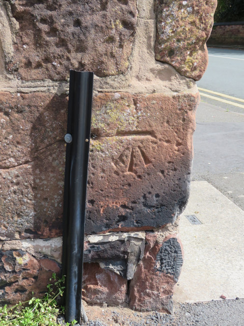
Image: © John S Turner Taken: 24 Apr 2017
Ordnance Survey bench mark on the corner of The King's Gap road, at its junction with Valentia Road, Hoylake. See also: Image
Images are licensed for reuse under creativecommons.org/licenses/by-sa/2.0
Image Location
Latitude
53.391422
Longitude
-3.183376