View from Anchor Lane, Dundee
Introduction
The photograph on this page of View from Anchor Lane, Dundee by Chris Allen as part of the Geograph project.
The Geograph project started in 2005 with the aim of publishing, organising and preserving representative images for every square kilometre of Great Britain, Ireland and the Isle of Man.

There are currently over 7.5m images from over 14,400 individuals and you can help contribute to the project by visiting https://www.geograph.org.uk
View from Anchor Lane, Dundee
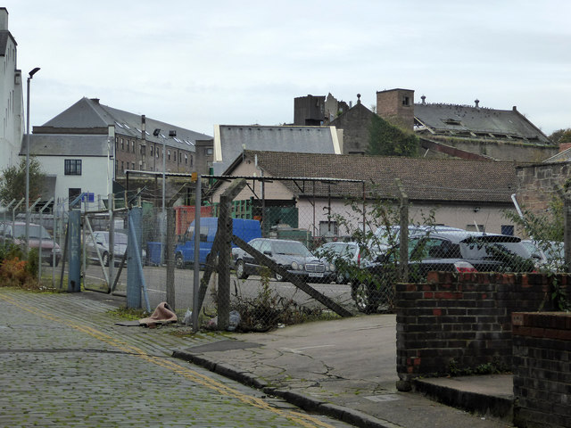
Image: © Chris Allen Taken: 21 Oct 2016
At this point I ran out of time to explore further and had to dive into Verdant Works to achieve my main objective of the day - an 1801 Boulton & Watt beam engine. So I had to content myself with this tantalising shot that I have just spent a good 15 minutes locating accurately. The multistorey block in the left background is part of Logie Works built 1828-33 and was converted to housing in the 1990s. It sounds fascinating with a coffin shaped courtyard and two beam engine houses. The decaying mill buildings in the right background are part of Queen Victoria Works that were still spinning jute until 1995. The aerial view shows severe deterioration. Dundee has a mass of industrial archaeology that I barely scratched the surface of. It would take a good week to do the place justice.
Images are licensed for reuse under creativecommons.org/licenses/by-sa/2.0
Image Location
Latitude
56.461556
Longitude
-2.985485