England Coast Path Signage, Newbiggin-By-The-Sea
Introduction
The photograph on this page of England Coast Path Signage, Newbiggin-By-The-Sea by Geoff Holland as part of the Geograph project.
The Geograph project started in 2005 with the aim of publishing, organising and preserving representative images for every square kilometre of Great Britain, Ireland and the Isle of Man.

There are currently over 7.5m images from over 14,400 individuals and you can help contribute to the project by visiting https://www.geograph.org.uk
England Coast Path Signage, Newbiggin-By-The-Sea
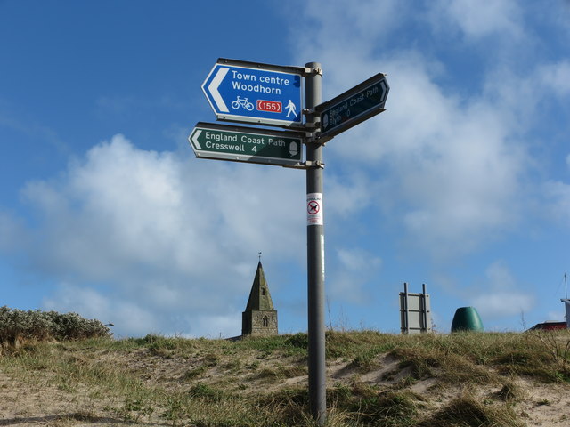
Image: © Geoff Holland Taken: 20 Mar 2020
This sign, along with other similar signs, is a relatively recent addition to the local landscape and indicates the route of the England Coast Path through the area. The path, which will be the longest waymarked and managed coastal path in the world, passes through the North East of England from the Wash in the south to the Scottish Border in the north. The post also contains a sign for Route 155 of the National Cycle Network (NCN) which is a Sustrans regional route running from the North Sea coast at Newbiggin to the market town of Morpeth
Images are licensed for reuse under creativecommons.org/licenses/by-sa/2.0
Image Location
Latitude
55.18591
Longitude
-1.505107