Old Boundary Marker
Introduction
The photograph on this page of Old Boundary Marker by D Markwell as part of the Geograph project.
The Geograph project started in 2005 with the aim of publishing, organising and preserving representative images for every square kilometre of Great Britain, Ireland and the Isle of Man.

There are currently over 7.5m images from over 14,400 individuals and you can help contribute to the project by visiting https://www.geograph.org.uk
Old Boundary Marker
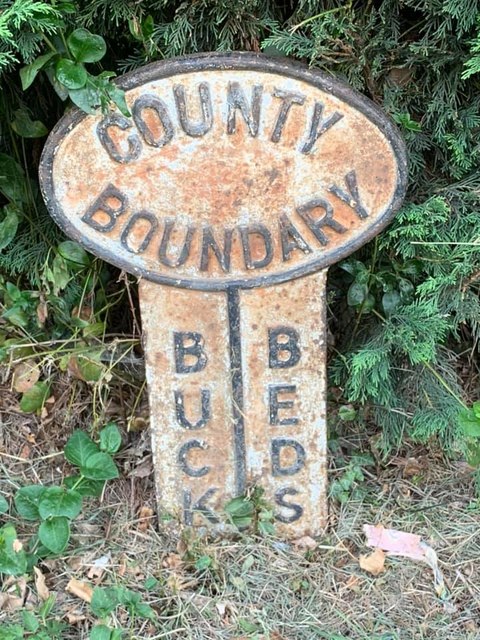
Image: © D Markwell Taken: 12 Jul 2019
County Boundary Marker on the southwest side of the junction of Cranfield Road and Crow Lane. WAVENDON parish. Inscribed BUCKS | BEDS on its centre face and COUNTY / BOUNDARY at the top. See also http://pnelson.orpheusweb.co.uk/boundsbuck/boundsbuck1/gallery.htm Milestone Society National ID: BU_WBCR00cb
Images are licensed for reuse under creativecommons.org/licenses/by-sa/2.0
Image Location
Latitude
52.031262
Longitude
-0.644915