Maen Pebyll long barrow
Introduction
The photograph on this page of Maen Pebyll long barrow by Jonathan Wilkins as part of the Geograph project.
The Geograph project started in 2005 with the aim of publishing, organising and preserving representative images for every square kilometre of Great Britain, Ireland and the Isle of Man.

There are currently over 7.5m images from over 14,400 individuals and you can help contribute to the project by visiting https://www.geograph.org.uk
Maen Pebyll long barrow
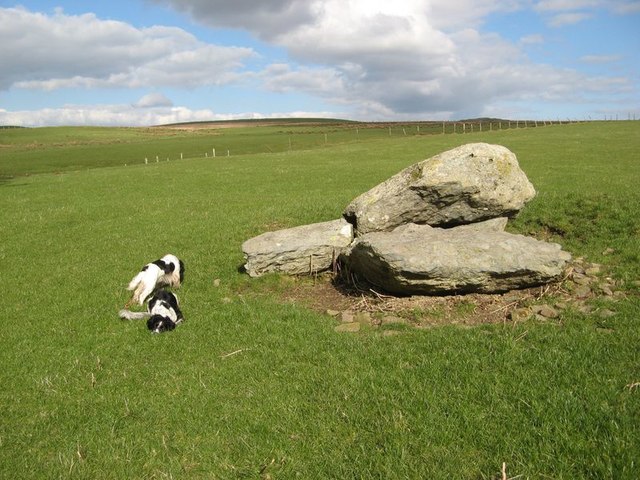
Image: © Jonathan Wilkins Taken: 20 Mar 2020
Finding such a small feature was a surprise. Documents give the original size as 117 x 70 feet, but all which remains is a collapsed cromlech. It appears that many ancient structures in this district were robbed for stones for enclosures in the early nineteenth century, and the remains of the mound ploughed out.
Images are licensed for reuse under creativecommons.org/licenses/by-sa/2.0
Image Location


Leaflet Map data © OpenStreetMap
Latitude
53.094491
Longitude
-3.728229