Maddock Way, Brandon Estate, 1966
Introduction
The photograph on this page of Maddock Way, Brandon Estate, 1966 by Alan Murray-Rust as part of the Geograph project.
The Geograph project started in 2005 with the aim of publishing, organising and preserving representative images for every square kilometre of Great Britain, Ireland and the Isle of Man.

There are currently over 7.5m images from over 14,400 individuals and you can help contribute to the project by visiting https://www.geograph.org.uk
Maddock Way, Brandon Estate, 1966
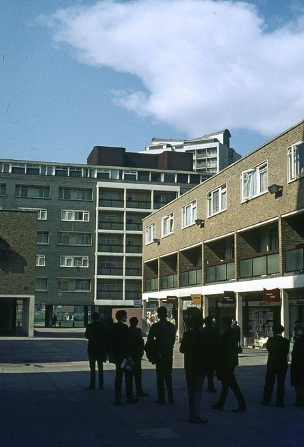
Image: © Alan Murray-Rust Taken: 25 Apr 1966
Shopping precinct forming part of the Brandon Estate development of the late 1950s/early 1960s. Compare with https://www.geograph.org.uk/photo/911234 from 2005. One particular feature that has disappeared is the row of 'flags' indicating individual shops in the row.
Images are licensed for reuse under creativecommons.org/licenses/by-sa/2.0
Image Location
Latitude
51.482541
Longitude
-0.10302