Medieval barn on Crownhill Down
Introduction
The photograph on this page of Medieval barn on Crownhill Down by Sandy Gerrard as part of the Geograph project.
The Geograph project started in 2005 with the aim of publishing, organising and preserving representative images for every square kilometre of Great Britain, Ireland and the Isle of Man.

There are currently over 7.5m images from over 14,400 individuals and you can help contribute to the project by visiting https://www.geograph.org.uk
Medieval barn on Crownhill Down
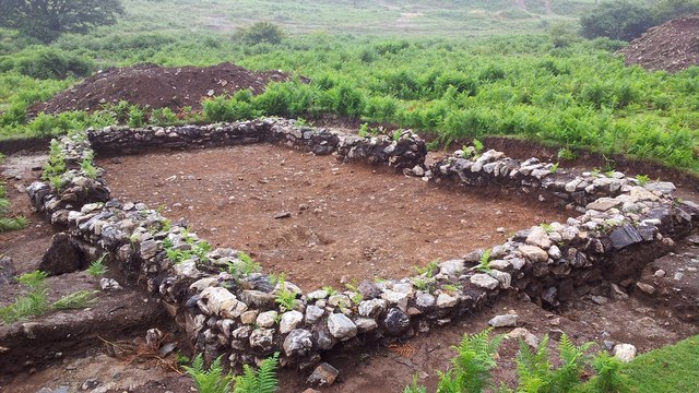
Image: © Sandy Gerrard Taken: 30 Jul 2013
This medieval building was probably a barn originally associated with a nearby farmstead. The building was archaeologically excavated in 2013 prior to being buried beneath waste from Drakelands tungsten mine. https://earlytin.wordpress.com/surveys/crownhill-down/
Images are licensed for reuse under creativecommons.org/licenses/by-sa/2.0
Image Location


Leaflet Map data © OpenStreetMap
Latitude
50.418375
Longitude
-4.02883