Clacton-on-Sea: Railway lines approaching Clacton-on-Sea station
Introduction
The photograph on this page of Clacton-on-Sea: Railway lines approaching Clacton-on-Sea station by Nigel Cox as part of the Geograph project.
The Geograph project started in 2005 with the aim of publishing, organising and preserving representative images for every square kilometre of Great Britain, Ireland and the Isle of Man.

There are currently over 7.5m images from over 14,400 individuals and you can help contribute to the project by visiting https://www.geograph.org.uk
Clacton-on-Sea: Railway lines approaching Clacton-on-Sea station
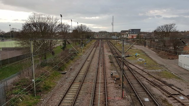
Image: © Nigel Cox Taken: 15 Mar 2020
The trackwork is viewed here from the Oxford Road footbridge, looking towards Clacton-on-Sea station. Old large scale Ordnance Survey maps show that there were at least 6 parallel tracks through here when the railway was at its peak.
Images are licensed for reuse under creativecommons.org/licenses/by-sa/2.0
Image Location
Latitude
51.798217
Longitude
1.157868