Mansion Alley
Introduction
The photograph on this page of Mansion Alley by Ian Capper as part of the Geograph project.
The Geograph project started in 2005 with the aim of publishing, organising and preserving representative images for every square kilometre of Great Britain, Ireland and the Isle of Man.

There are currently over 7.5m images from over 14,400 individuals and you can help contribute to the project by visiting https://www.geograph.org.uk
Mansion Alley
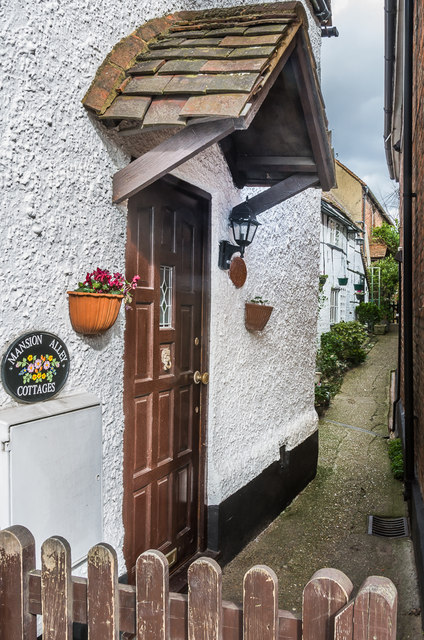
Image: © Ian Capper Taken: 12 Mar 2020
Hidden alley of cottages off Church Street. 35 Church Street, on the left, dates from the 18th Century and 1 and 2 Mansion Cottages, beyond, from the 17th Century or earlier. Grade II listed - see www.historicengland.org.uk/listing/the-list/list-entry/1028617.
Images are licensed for reuse under creativecommons.org/licenses/by-sa/2.0
Image Location
Latitude
51.293602
Longitude
-0.328286