Holt ways [4]
Introduction
The photograph on this page of Holt ways [4] by Michael Dibb as part of the Geograph project.
The Geograph project started in 2005 with the aim of publishing, organising and preserving representative images for every square kilometre of Great Britain, Ireland and the Isle of Man.

There are currently over 7.5m images from over 14,400 individuals and you can help contribute to the project by visiting https://www.geograph.org.uk
Holt ways [4]
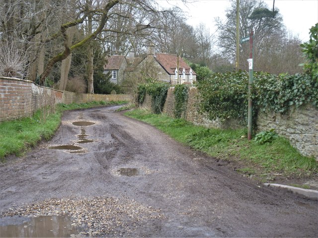
Image: © Michael Dibb Taken: 7 Mar 2020
This track, alongside the church of St Katherine, provides access to some houses and then becomes a footpath leading to Station Road. Two miles north east of Bradford-on-Avon the village of Holt originally consisted of a settlement around the church and an area around a triangular green called The Ham. The village greatly expanded in the later 20th century. Primarily an agricultural village, it was briefly a spa and there was a woollen cloth mill and factories producing leather, gloves and beds. Now a commuter village with workers travelling to Melksham, Trowbridge and Bradford-on-Avon.
Images are licensed for reuse under creativecommons.org/licenses/by-sa/2.0
Image Location
Latitude
51.353212
Longitude
-2.201279