Listed barn near The Elms
Introduction
The photograph on this page of Listed barn near The Elms by Richard Law as part of the Geograph project.
The Geograph project started in 2005 with the aim of publishing, organising and preserving representative images for every square kilometre of Great Britain, Ireland and the Isle of Man.

There are currently over 7.5m images from over 14,400 individuals and you can help contribute to the project by visiting https://www.geograph.org.uk
Listed barn near The Elms
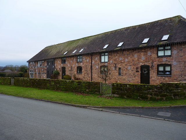
Image: © Richard Law Taken: 31 Dec 2019
The fabric of the barn is thought to be 18th century, particularly the far end which still displays its timber frmming, although the nearer end has been rebuilt, most likely in the 19th. The whole structure attracted a Grade II listing https://britishlistedbuildings.co.uk/101367612-barn-about-60-metres-south-east-of-the-elms-albrighton & https://historicengland.org.uk/listing/the-list/list-entry/1367612 in 1984. Unsurprisingly, it's now converted to housing.
Images are licensed for reuse under creativecommons.org/licenses/by-sa/2.0
Image Location
Latitude
52.632861
Longitude
-2.288225