Shermanbury Grange
Introduction
The photograph on this page of Shermanbury Grange by Ian Hawfinch as part of the Geograph project.
The Geograph project started in 2005 with the aim of publishing, organising and preserving representative images for every square kilometre of Great Britain, Ireland and the Isle of Man.

There are currently over 7.5m images from over 14,400 individuals and you can help contribute to the project by visiting https://www.geograph.org.uk
Shermanbury Grange
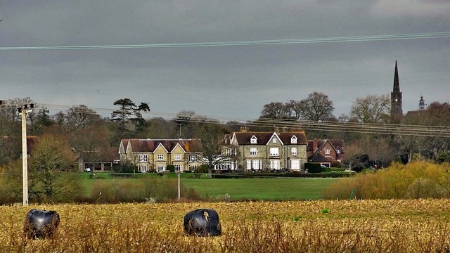
Image: © Ian Hawfinch Taken: 15 Mar 2020
This is a cross-grid telephoto shot. The camera was on the Downs Link footpath in TQ1917 - about 1.5 km away. The spire of St Hugh's Charterhouse monastery can also be seen on the right. The monastery is about 3 km from the camera.
Images are licensed for reuse under creativecommons.org/licenses/by-sa/2.0
Image Location
Latitude
50.95891
Longitude
-0.291313