Former Wind Turbine at Mount Todden
Introduction
The photograph on this page of Former Wind Turbine at Mount Todden by Des Blenkinsopp as part of the Geograph project.
The Geograph project started in 2005 with the aim of publishing, organising and preserving representative images for every square kilometre of Great Britain, Ireland and the Isle of Man.

There are currently over 7.5m images from over 14,400 individuals and you can help contribute to the project by visiting https://www.geograph.org.uk
Former Wind Turbine at Mount Todden
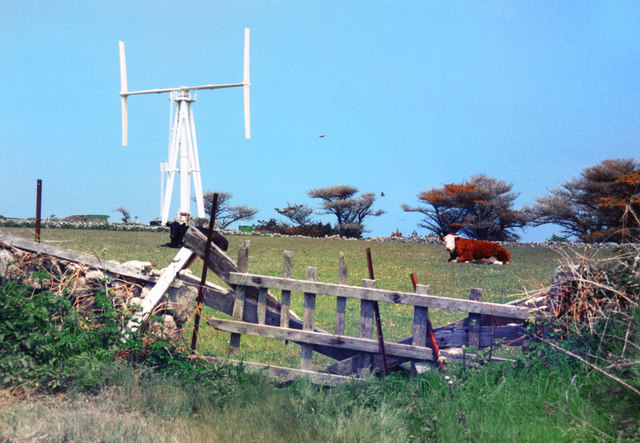
Image: © Des Blenkinsopp Taken: Unknown
I took this picture of a wind turbine on our first visit to Scilly back in the mid 1990s. On our next visit it wasn't there any more and I was told it had been blown down. I can't find any other pictures of it on the web. From a print and the colours have aged a bit. Also the exact date is uncertain. Thanks to Roger Banfield and Kate Hale via the Isles of Scilly Museum for help in locating the site and providing extra information, including confirmation of the storm damage story as follows. "Having put this out to the informed locals, it would appear that it did indeed blow down." "The wind turbine eventually came apart, and was then dismantled. As there was a large electricity transformer next to it, the Council then installed the desalination plant in the same area (Mount Todden), in the early 1990's. The desalination plant needed a 90Kw supply for the twin units installed."
Images are licensed for reuse under creativecommons.org/licenses/by-sa/2.0
Image Location
Latitude
49.923169
Longitude
-6.280589