Harold's Stones prehistoric stone row
Introduction
The photograph on this page of Harold's Stones prehistoric stone row by Sandy Gerrard as part of the Geograph project.
The Geograph project started in 2005 with the aim of publishing, organising and preserving representative images for every square kilometre of Great Britain, Ireland and the Isle of Man.

There are currently over 7.5m images from over 14,400 individuals and you can help contribute to the project by visiting https://www.geograph.org.uk
Harold's Stones prehistoric stone row
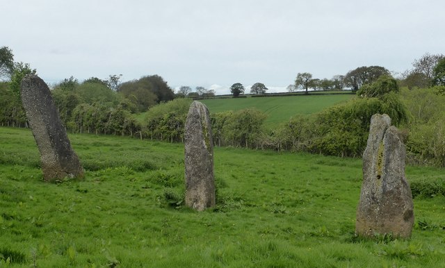
Image: © Sandy Gerrard Taken: 12 May 2018
A probable single prehistoric stone row measuring 13.7m long, including three large upright orthostats. The row is orientated north east to south west and stands within a medieval township and later field system. The central stone has a pair of cup-marks on one face. https://stonerows.wordpress.com/gazetteer/region/wales/harolds-stones/
Images are licensed for reuse under creativecommons.org/licenses/by-sa/2.0
Image Location
Latitude
51.742712
Longitude
-2.726725