Whitstable station
Introduction
The photograph on this page of Whitstable station by Marathon as part of the Geograph project.
The Geograph project started in 2005 with the aim of publishing, organising and preserving representative images for every square kilometre of Great Britain, Ireland and the Isle of Man.

There are currently over 7.5m images from over 14,400 individuals and you can help contribute to the project by visiting https://www.geograph.org.uk
Whitstable station
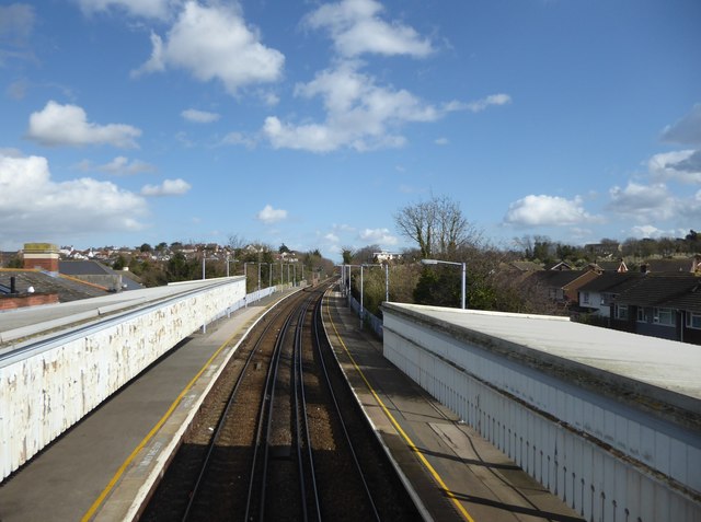
Image: © Marathon Taken: 12 Mar 2020
The line between Faversham and Whitstable was opened by the Margate Railway on 1st August 1860, and was extended to Herne Bay on 13th July 1861. The first station on that line to serve Whitstable was in Oxford Street, and was known as Whitstable Town; it closed after the last train on 31st December 1914. The following day, a new station was opened just under half a mile to the east and this was named Whitstable Town & Tankerton. The station was renamed Whitstable & Tankerton on 1st February 1936, and Whitstable in 1979. This view is from the footbridge. The next station in this direction is Chestfield and Swalecliffe.
Images are licensed for reuse under creativecommons.org/licenses/by-sa/2.0
Image Location
Latitude
51.357694
Longitude
1.034509