Ellon: the bridges
Introduction
The photograph on this page of Ellon: the bridges by Bill Harrison as part of the Geograph project.
The Geograph project started in 2005 with the aim of publishing, organising and preserving representative images for every square kilometre of Great Britain, Ireland and the Isle of Man.

There are currently over 7.5m images from over 14,400 individuals and you can help contribute to the project by visiting https://www.geograph.org.uk
Ellon: the bridges
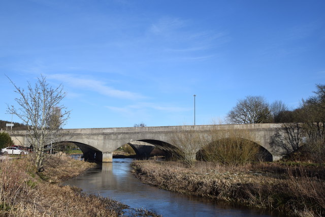
Image: © Bill Harrison Taken: 1 Mar 2020
In front, the concrete New Bridge from ca. 1939 (Canmore listing 281614: https://canmore.org.uk/site/281614/ellon-new-bridge ) with a distinct slope from the south to the north bank of the River Ythan and just visible behind it, the granite Old Bridge from 1793 (Canmore listing 120072: https://canmore.org.uk/site/120072/ellon-old-bridge-of-ellon ).
Images are licensed for reuse under creativecommons.org/licenses/by-sa/2.0
Image Location
Latitude
57.363423
Longitude
-2.07346