Seafield Road
Introduction
The photograph on this page of Seafield Road by Ian Capper as part of the Geograph project.
The Geograph project started in 2005 with the aim of publishing, organising and preserving representative images for every square kilometre of Great Britain, Ireland and the Isle of Man.

There are currently over 7.5m images from over 14,400 individuals and you can help contribute to the project by visiting https://www.geograph.org.uk
Seafield Road
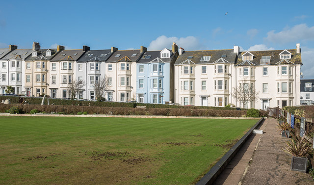
Image: © Ian Capper Taken: 8 Feb 2020
Terrace on Seafield Road, much of which is shown on the 1889 1:2,500 map, with the exception of the right hand section which first appears on the 1904 edition. On both maps it is marked as Seaview Crescent, the current name not appearing until the 1936 edition, prior to which it was applied to what is now Sea Hill. Viewed across the bowling green in Seafield and Festival Gardens.
Images are licensed for reuse under creativecommons.org/licenses/by-sa/2.0
Image Location
Latitude
50.704847
Longitude
-3.072976