Baydon Manor
Introduction
The photograph on this page of Baydon Manor by Vieve Forward as part of the Geograph project.
The Geograph project started in 2005 with the aim of publishing, organising and preserving representative images for every square kilometre of Great Britain, Ireland and the Isle of Man.

There are currently over 7.5m images from over 14,400 individuals and you can help contribute to the project by visiting https://www.geograph.org.uk
Baydon Manor
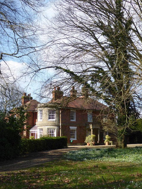
Image: © Vieve Forward Taken: 6 Mar 2020
Early 19th century Grade II listed brick built manor house, formerly known as Marridge Hill House. https://historicengland.org.uk/listing/the-list/list-entry/1300405
Images are licensed for reuse under creativecommons.org/licenses/by-sa/2.0
Image Location


Leaflet Map data © OpenStreetMap
Latitude
51.471349
Longitude
-1.587329