Keady Tunnel
Introduction
The photograph on this page of Keady Tunnel by Sean Davis as part of the Geograph project.
The Geograph project started in 2005 with the aim of publishing, organising and preserving representative images for every square kilometre of Great Britain, Ireland and the Isle of Man.

There are currently over 7.5m images from over 14,400 individuals and you can help contribute to the project by visiting https://www.geograph.org.uk
Keady Tunnel
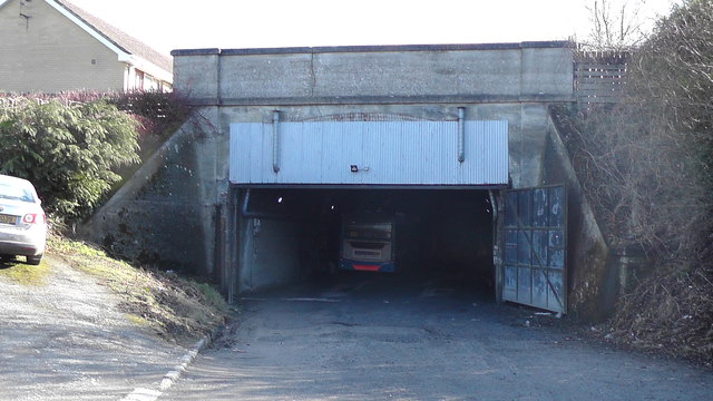
Image: © Sean Davis Taken: 4 Mar 2020
The Keady Tunnel was built c1909 to take the proposed Ulster and Connacht Light Railway. The railway was to join Newry to Clifden. The route was to go through Bessbrook, Keady, Tynan, Maguiresbridge, Drumod, Roscommon, Tuam and Galway. However, the railway was not built and the tunnel is now used as a bus garage.
Images are licensed for reuse under creativecommons.org/licenses/by-sa/2.0
Image Location
Latitude
54.252566
Longitude
-6.699814