Ogmore & Garw Valleys direction & distances sign, Station Road, Treorchy
Introduction
The photograph on this page of Ogmore & Garw Valleys direction & distances sign, Station Road, Treorchy by Jaggery as part of the Geograph project.
The Geograph project started in 2005 with the aim of publishing, organising and preserving representative images for every square kilometre of Great Britain, Ireland and the Isle of Man.

There are currently over 7.5m images from over 14,400 individuals and you can help contribute to the project by visiting https://www.geograph.org.uk
Ogmore & Garw Valleys direction & distances sign, Station Road, Treorchy
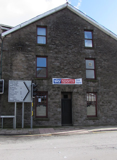
Image: © Jaggery Taken: 6 Mar 2020
The sign at the northern end of Station Road shows Bridgend 15 (miles), Cymer (Afan) 10, Port Talbot 19. Nearer locations are the hospital Ysbyty George Thomas and Cwmparc.
Images are licensed for reuse under creativecommons.org/licenses/by-sa/2.0
Image Location
Latitude
51.659508
Longitude
-3.505799