Shrewton features [2]
Introduction
The photograph on this page of Shrewton features [2] by Michael Dibb as part of the Geograph project.
The Geograph project started in 2005 with the aim of publishing, organising and preserving representative images for every square kilometre of Great Britain, Ireland and the Isle of Man.

There are currently over 7.5m images from over 14,400 individuals and you can help contribute to the project by visiting https://www.geograph.org.uk
Shrewton features [2]
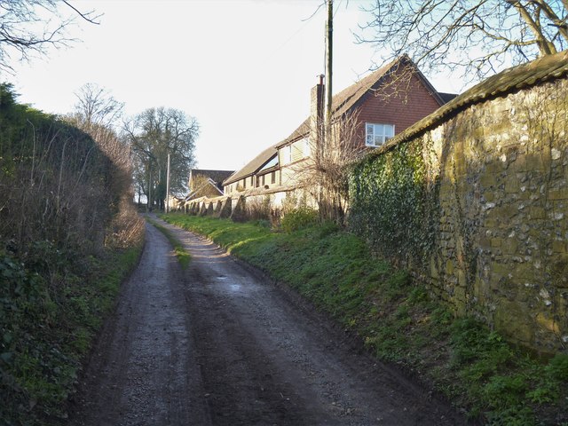
Image: © Michael Dibb Taken: 29 Jan 2020
The wall on the right of this un-named track runs around some 20th century housing in Abbey Close, Priory Close and Manor Close. Built circa 1600, and probably the close walls of the Grange at Maddington, formerly of the Benedictine nunnery at Amesbury. Listed, grade II, with details at: https://historicengland.org.uk/listing/the-list/list-entry/1355686 The village of Shrewton is located on Salisbury Plain and is made up of several early communities and was, until 1934 three separate parishes. The name Shrewton comes from the Old English word for sheriff’s farm or settlement. The village lies on the east to west road from London to Bridgwater via Amesbury and Warminster. The River Till which rises near Tilshead flows through the village on its way to join the River Wylye near Stapleford.
Images are licensed for reuse under creativecommons.org/licenses/by-sa/2.0
Image Location
Latitude
51.193024
Longitude
-1.906934