Crook of Alves
Introduction
The photograph on this page of Crook of Alves by Anne Burgess as part of the Geograph project.
The Geograph project started in 2005 with the aim of publishing, organising and preserving representative images for every square kilometre of Great Britain, Ireland and the Isle of Man.

There are currently over 7.5m images from over 14,400 individuals and you can help contribute to the project by visiting https://www.geograph.org.uk
Crook of Alves
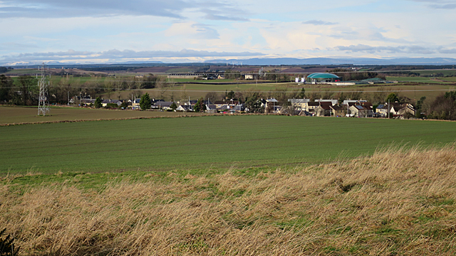
Image: © Anne Burgess Taken: 25 Feb 2020
Although named simply as Alves on maps these days, older maps use the full name, Crook of Alves. From here, one is blissfully unaware of the busy A96 that carries heavy traffic along the edge of the village. The conspicuous green domes in the distance are biomass digesters at Wester Alves Farm. The name is pronounced AH-viss, by the way - the 'l' is silent and it has two syllables. Not 'alvz'.
Images are licensed for reuse under creativecommons.org/licenses/by-sa/2.0
Image Location
Latitude
57.642033
Longitude
-3.449808