Former driveway to Broomhill
Introduction
The photograph on this page of Former driveway to Broomhill by Richard Sutcliffe as part of the Geograph project.
The Geograph project started in 2005 with the aim of publishing, organising and preserving representative images for every square kilometre of Great Britain, Ireland and the Isle of Man.

There are currently over 7.5m images from over 14,400 individuals and you can help contribute to the project by visiting https://www.geograph.org.uk
Former driveway to Broomhill
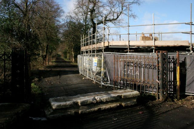
Image: © Richard Sutcliffe Taken: 23 Feb 2020
This was originally the drive to a large villa called Broomhill (later Broomhill Hospital). The hospital complex closed in 1995. Behind the scaffolding, barriers and screens on the right is the former lodge to the house. It dates from the earlier to mid 19th century. The lodge, boundary wall, gatepiers and gates are Category C listed http://portal.historicenvironment.scot/designation/LB49875. On the Buildings at Risk Register https://www.buildingsatrisk.org.uk/details/906940, Listed Building Consent was sought in July 2019, and the building has subsequently been partly demolished as part of a development by Cala Homes. It remains to be seen how sympathetically it is rebuilt.
Images are licensed for reuse under creativecommons.org/licenses/by-sa/2.0
Image Location
Latitude
55.943415
Longitude
-4.149352