Houses close to the brink, Fairlight Cove
Introduction
The photograph on this page of Houses close to the brink, Fairlight Cove by Robin Webster as part of the Geograph project.
The Geograph project started in 2005 with the aim of publishing, organising and preserving representative images for every square kilometre of Great Britain, Ireland and the Isle of Man.

There are currently over 7.5m images from over 14,400 individuals and you can help contribute to the project by visiting https://www.geograph.org.uk
Houses close to the brink, Fairlight Cove
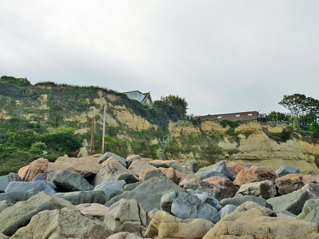
Image: © Robin Webster Taken: 5 Jul 2012
On Sea Road. Towards the right there are now no more permanent houses on the sea side of the road for some way because of cliff falls and the road itself is closed to vehicles. The near rocks are imported to act as a barrier to sea erosion of the cliff foot.
Images are licensed for reuse under creativecommons.org/licenses/by-sa/2.0
Image Location
Latitude
50.877525
Longitude
0.671653