Junction of Glentworth Street and Ivor Place, Marylebone, London
Introduction
The photograph on this page of Junction of Glentworth Street and Ivor Place, Marylebone, London by Robin Stott as part of the Geograph project.
The Geograph project started in 2005 with the aim of publishing, organising and preserving representative images for every square kilometre of Great Britain, Ireland and the Isle of Man.

There are currently over 7.5m images from over 14,400 individuals and you can help contribute to the project by visiting https://www.geograph.org.uk
Junction of Glentworth Street and Ivor Place, Marylebone, London
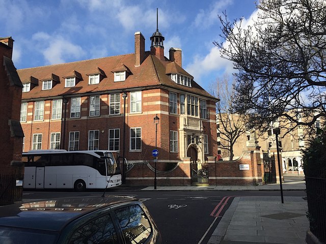
Image: © Robin Stott Taken: 28 Jan 2020
The splendid Edwardian building on the corner has an inscription over the door which reads: 'Francis Holland / Church of England School / for Girls founded MDCCCXXVIII [1828] / Built on this Site MCMXV [1915]'. Architect: H T Hare. Listed Grade II https://historicengland.org.uk/listing/the-list/list-entry/1226183 The address is given as Park Road NW1. See also Image
Images are licensed for reuse under creativecommons.org/licenses/by-sa/2.0
Image Location


Leaflet Map data © OpenStreetMap
Latitude
51.524634
Longitude
-0.159943