Pantomime Steps
Introduction
The photograph on this page of Pantomime Steps by Keith Williamson as part of the Geograph project.
The Geograph project started in 2005 with the aim of publishing, organising and preserving representative images for every square kilometre of Great Britain, Ireland and the Isle of Man.

There are currently over 7.5m images from over 14,400 individuals and you can help contribute to the project by visiting https://www.geograph.org.uk
Pantomime Steps
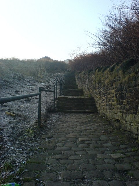
Image: © Keith Williamson Taken: 20 Dec 2007
Sets of old cobbled steps, rising about 30 metres, linking Tower Street and Prospect Road. These steps divide Dukinfield Cemetery (to the right) from an area of open public space known as The Sandhills.
Images are licensed for reuse under creativecommons.org/licenses/by-sa/2.0
Image Location
Latitude
53.479238
Longitude
-2.078615