Coal tax boundary post no.46, Water Lane - detail
Introduction
The photograph on this page of Coal tax boundary post no.46, Water Lane - detail by Mike Quinn as part of the Geograph project.
The Geograph project started in 2005 with the aim of publishing, organising and preserving representative images for every square kilometre of Great Britain, Ireland and the Isle of Man.

There are currently over 7.5m images from over 14,400 individuals and you can help contribute to the project by visiting https://www.geograph.org.uk
Coal tax boundary post no.46, Water Lane - detail
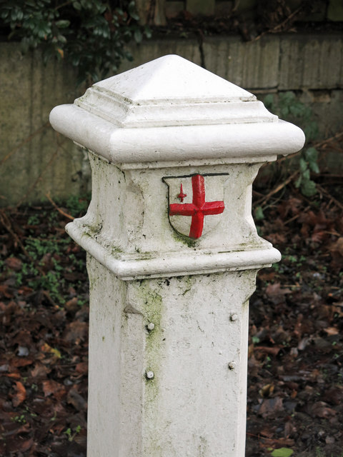
Image: © Mike Quinn Taken: 15 Jan 2020
See Image and Image Here, the correction plate is missing, but all four retaining bolts are in place. The original inscription - "14 & 15 VICT / CAP 146" - appears to have been completely ground off when the correction plate was fitted.
Images are licensed for reuse under creativecommons.org/licenses/by-sa/2.0
Image Location


Leaflet Map data © OpenStreetMap
Latitude
51.65397
Longitude
-0.388036