Hyde Road
Introduction
The photograph on this page of Hyde Road by Gerald England as part of the Geograph project.
The Geograph project started in 2005 with the aim of publishing, organising and preserving representative images for every square kilometre of Great Britain, Ireland and the Isle of Man.

There are currently over 7.5m images from over 14,400 individuals and you can help contribute to the project by visiting https://www.geograph.org.uk
Hyde Road
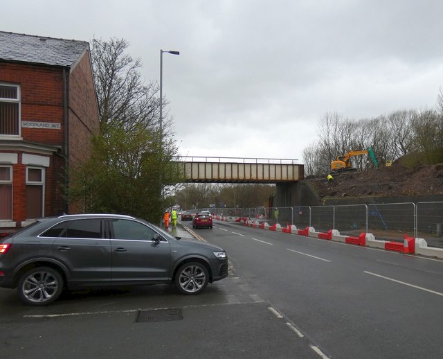
Image: © Gerald England Taken: 18 Feb 2020
Work has started on the A57 Hyde Road Widening Scheme. The old railway bridge is due to be removed in a few days time. The bridge is used by cyclists and walkers on the Fallowfield Loop. It will be replaced by a new longer-span bridge later in the year.
Images are licensed for reuse under creativecommons.org/licenses/by-sa/2.0
Image Location
Latitude
53.459287
Longitude
-2.163972