Kears Row/Rhes Kears in Varteg
Introduction
The photograph on this page of Kears Row/Rhes Kears in Varteg by Jaggery as part of the Geograph project.
The Geograph project started in 2005 with the aim of publishing, organising and preserving representative images for every square kilometre of Great Britain, Ireland and the Isle of Man.

There are currently over 7.5m images from over 14,400 individuals and you can help contribute to the project by visiting https://www.geograph.org.uk
Kears Row/Rhes Kears in Varteg
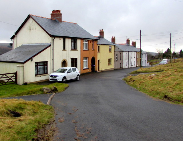
Image: © Jaggery Taken: 15 Mar 2018
Row of houses below the east side of the B4246 Varteg Road. Coflein records that Kears Row (Rhes Kears in Welsh) was originally a row of four early 19th century houses built for workmen associated with Varteg Ironworks. The first edition Ordnance Survey shows a brewery at the end of the row, probably now the yellow house - the two houses on the left appear to be later additions to the row.
Images are licensed for reuse under creativecommons.org/licenses/by-sa/2.0
Image Location
Latitude
51.748677
Longitude
-3.064768