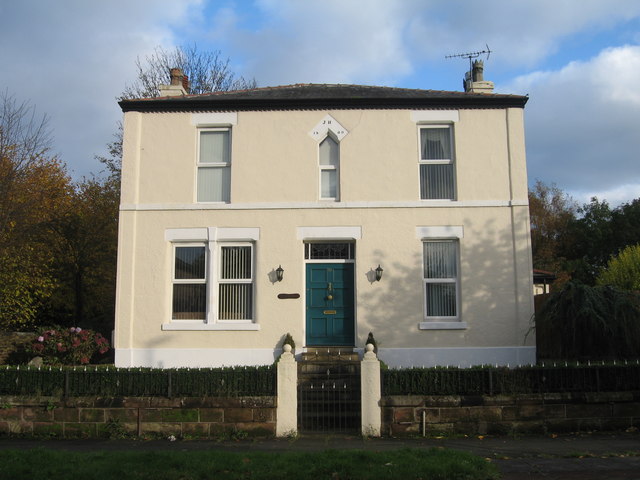
Brookfield, Wash Lane
Introduction
The photograph on this page of Brookfield, Wash Lane by Sue Adair as part of the Geograph project.
The Geograph project started in 2005 with the aim of publishing, organising and preserving representative images for every square kilometre of Great Britain, Ireland and the Isle of Man.
There are currently over 7.5m images from over 14,400 individuals and you can help contribute to the project by visiting https://www.geograph.org.uk

Image: © Sue Adair Taken: 3 Nov 2019
Brookfield cottage in Wash Lane, the house is dated 1809 with the initials JH and predates the adjacent schoolroom and church. It is known that Joseph Hughes, a toolmaker, his brother John and wife Hannah lived in the house at the end of the 19th century. Wash Lane was the old road to London and almost opposite stood the black and white half-timbered house known as the Plague House which was built in 1656 by Richard Warburton. It is likely that those who died of the plague here were not buried in the consecrated ground of the parish but interred in the field immediately behind the plague house, which was at the time glebe land. No doubt this accounted for the human remains discovered in the mid 19th century and plotted on the 1875 map. The plague house was demolished in 1957. More information:- https://deathsplaining.wordpress.com/2014/01/14/the-plague-house/

