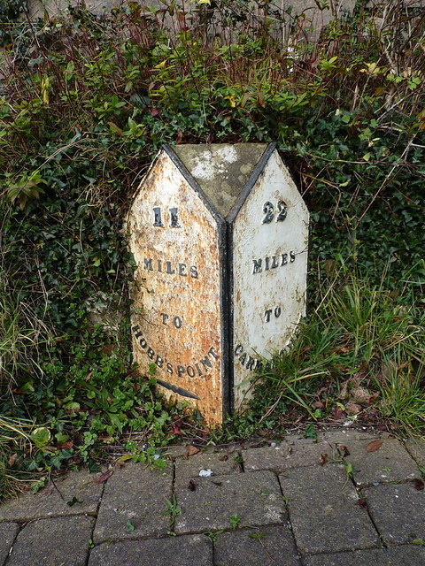
The Kilgetty milestone
Introduction
The photograph on this page of The Kilgetty milestone by Richard Law as part of the Geograph project.
The Geograph project started in 2005 with the aim of publishing, organising and preserving representative images for every square kilometre of Great Britain, Ireland and the Isle of Man.
There are currently over 7.5m images from over 14,400 individuals and you can help contribute to the project by visiting https://www.geograph.org.uk

Image: © Richard Law Taken: 23 Dec 2019
Situated on the north side of the road, more or less opposite the Co-op, and recording 11 miles to Hobb's Point and 22 miles to Carmarthen. It was only when a resident saw my interest asked me if I had spotted the 'flaw' in these mileages that the penny dropped - the milestone is now on the wrong side of the road; Carmarthen is to the east of here (ie off to the right) so that plate should have been legible as you approached the stone. Hence it started life on the south side of the road, and has been repositioned at some stage.

