Salisbury bridges [10]
Introduction
The photograph on this page of Salisbury bridges [10] by Michael Dibb as part of the Geograph project.
The Geograph project started in 2005 with the aim of publishing, organising and preserving representative images for every square kilometre of Great Britain, Ireland and the Isle of Man.

There are currently over 7.5m images from over 14,400 individuals and you can help contribute to the project by visiting https://www.geograph.org.uk
Salisbury bridges [10]
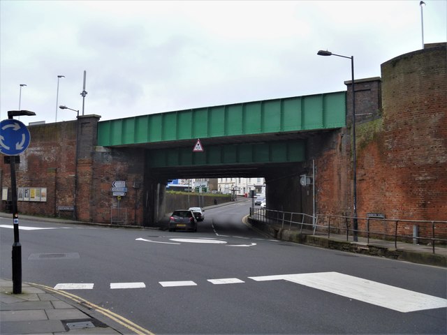
Image: © Michael Dibb Taken: 31 Dec 2019
This bridge carries the railway over Fisherton Street. The bridge was strengthened in December 2019. Salisbury station is just a few yards to the left. A cathedral was established at the Iron Age hillfort of Old Sarum by the Normans. In 1220 the cathedral was removed to the nearby plain and New Sarum (Salisbury) grew up around it, receiving a city charter in 1227. Located at the confluence of five rivers (Avon, Nadder, Ebble, Wylye and Bourne) the city is prone to flooding. Traffic between the ports of Southampton and Bristol, passes around the city's ring-road via the A36 causing much congestion.
Images are licensed for reuse under creativecommons.org/licenses/by-sa/2.0
Image Location
Latitude
51.070695
Longitude
-1.803703