Grade II Listed Alandale, Pen-y-Pound, Abergavenny
Introduction
The photograph on this page of Grade II Listed Alandale, Pen-y-Pound, Abergavenny by Jaggery as part of the Geograph project.
The Geograph project started in 2005 with the aim of publishing, organising and preserving representative images for every square kilometre of Great Britain, Ireland and the Isle of Man.

There are currently over 7.5m images from over 14,400 individuals and you can help contribute to the project by visiting https://www.geograph.org.uk
Grade II Listed Alandale, Pen-y-Pound, Abergavenny
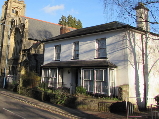
Image: © Jaggery Taken: 29 Dec 2019
Cadw records that Alandale is an early 19th century simple classical house which is shown on Wood's map of 1834. It was formerly the manse (minister's house) for the adjacent Whitefield Presbyterian Church https://www.geograph.org.uk/photo/2735186. Alandale was Grade II Listed in 2002.
Images are licensed for reuse under creativecommons.org/licenses/by-sa/2.0
Image Location


Leaflet Map data © OpenStreetMap
Latitude
51.825132
Longitude
-3.021008