Coal tax boundary post no.48, New Street / Church Street
Introduction
The photograph on this page of Coal tax boundary post no.48, New Street / Church Street by Mike Quinn as part of the Geograph project.
The Geograph project started in 2005 with the aim of publishing, organising and preserving representative images for every square kilometre of Great Britain, Ireland and the Isle of Man.

There are currently over 7.5m images from over 14,400 individuals and you can help contribute to the project by visiting https://www.geograph.org.uk
Coal tax boundary post no.48, New Street / Church Street
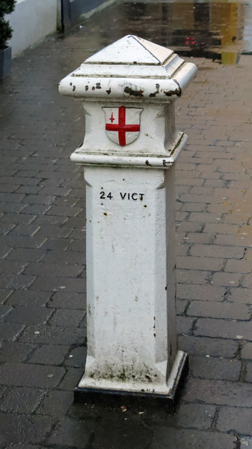
Image: © Mike Quinn Taken: 15 Jan 2020
The location of this post is shown in Image and Image This post was originally located almost a mile to the southeast on the south side of Capel Road at its junction with Pinner Road; it was moved in 1968. It has been set quite low into the ground; these posts usually have a larger part of their black base showing - see for example Image There were originally nearly 280 coal tax posts located around London, of which about 210 are still extant; around 180 of these (85%) are 3 ft high white-painted square bollards with a pyramidal top, decorative raised bands, and the shield from the City of London’s arms, like this one. Photos of the coal tax posts on Geograph are at http://www.geograph.org.uk/search.php?i=86542993&page=1 . The posts were erected under the Coal and Wine Duties (Continuation) Act of 1861 to mark the points at which duty had to be paid on coal being transported to London. The boundary was set at that of the Metropolitan Police District, and the resulting revenue was used by the Corporation of the City of London to fund public works. For further info see http://www.coaldutyposts.org.uk/cityposts.html .
Images are licensed for reuse under creativecommons.org/licenses/by-sa/2.0
Image Location


Leaflet Map data © OpenStreetMap
Latitude
51.655257
Longitude
-0.396664