Old Milestone by the B3289, south of Playing Place
Introduction
The photograph on this page of Old Milestone by the B3289, south of Playing Place by Rosy Hanns as part of the Geograph project.
The Geograph project started in 2005 with the aim of publishing, organising and preserving representative images for every square kilometre of Great Britain, Ireland and the Isle of Man.

There are currently over 7.5m images from over 14,400 individuals and you can help contribute to the project by visiting https://www.geograph.org.uk
Old Milestone by the B3289, south of Playing Place
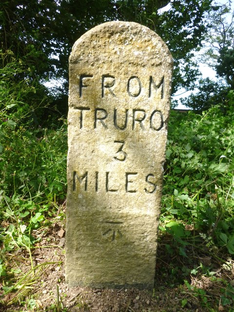
Image: © Rosy Hanns Taken: 26 Jun 2019
Carved stone post by the B3289, in parish of FEOCK (CARRICK District), Penelewey Barton, before Penelewey village sign, on the verge, on West side of road. Truro stone, erected by the Truro turnpike trust in the 19th century. Inscription reads:- FROM TRURO 3 MILES Carved benchmark on lower front face. Grade II listed. List Entry Number: 1140853 https://historicengland.org.uk/listing/the-list/list-entry/1140853 Milestone Society National ID: CW_TOKH03.
Images are licensed for reuse under creativecommons.org/licenses/by-sa/2.0
Image Location
Latitude
50.227706
Longitude
-5.064022