Ampere Way Tram Stop
Introduction
The photograph on this page of Ampere Way Tram Stop by Des Blenkinsopp as part of the Geograph project.
The Geograph project started in 2005 with the aim of publishing, organising and preserving representative images for every square kilometre of Great Britain, Ireland and the Isle of Man.

There are currently over 7.5m images from over 14,400 individuals and you can help contribute to the project by visiting https://www.geograph.org.uk
Ampere Way Tram Stop
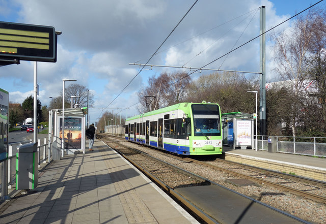
Image: © Des Blenkinsopp Taken: 11 Feb 2020
A new station on an old route, this was originally a conventional line built by the London, Brighton & South Coast Railway. It was converted to a tramway with many new stops, including here, which takes its name from one of the nearby streets with electrical names commemorating a large power station which used to be nearby. The Wikipedia entry for this stop https://en.wikipedia.org/wiki/Ampere_Way_tram_stop is brief but contains the following trivia snippet. "The station was renamed IKEA Ampere Way under a sponsorship deal on 18 October 2006, in order to promote the stop's location near IKEA's Croydon store. By March 2008, the station had reverted to its former name."
Images are licensed for reuse under creativecommons.org/licenses/by-sa/2.0
Image Location
Latitude
51.382249
Longitude
-0.12384