Vacant site, Wadebridge
Introduction
The photograph on this page of Vacant site, Wadebridge by Derek Harper as part of the Geograph project.
The Geograph project started in 2005 with the aim of publishing, organising and preserving representative images for every square kilometre of Great Britain, Ireland and the Isle of Man.

There are currently over 7.5m images from over 14,400 individuals and you can help contribute to the project by visiting https://www.geograph.org.uk
Vacant site, Wadebridge
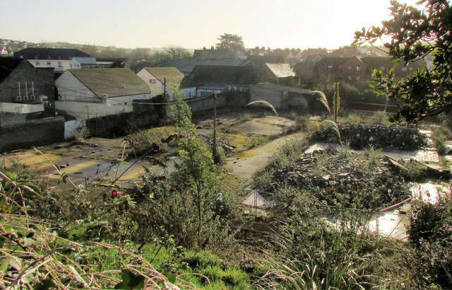
Image: © Derek Harper Taken: 8 Feb 2020
On Polmorla Road and seen from the wall at the bend of Park Road shown in Image One plan is to develop this into a retail centre and 37 dwellings. "The site was previously used as a bakery and dairy and is now derelict" https://www.cornwalllive.com/news/cornwall-news/plans-new-shopping-centre-37-2405688 .
Images are licensed for reuse under creativecommons.org/licenses/by-sa/2.0
Image Location
Latitude
50.515333
Longitude
-4.837397