Granary
Introduction
The photograph on this page of Granary by Ian Capper as part of the Geograph project.
The Geograph project started in 2005 with the aim of publishing, organising and preserving representative images for every square kilometre of Great Britain, Ireland and the Isle of Man.

There are currently over 7.5m images from over 14,400 individuals and you can help contribute to the project by visiting https://www.geograph.org.uk
Granary
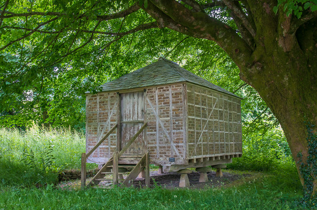
Image: © Ian Capper Taken: 15 Jun 2018
The granary at the National Trust owned Arlington Court. A plaque on the wall states "This early 19th Century granary, of a type common in Devon, formerly stood at Dunsland near Holsworthy. The corn was stored in wooden bins ranged round the walls. When Dunsland House was destroyed by fire in 1967, the granary was moved to Arlington by the National Trust." Grade II listed - www.historicengland.org.uk/listing/the-list/list-entry/1306968.
Images are licensed for reuse under creativecommons.org/licenses/by-sa/2.0
Image Location


Leaflet Map data © OpenStreetMap
Latitude
51.146408
Longitude
-3.983119