Old Guide Stone by the B3287, near Gargus Farm
Introduction
The photograph on this page of Old Guide Stone by the B3287, near Gargus Farm by Rosy Hanns as part of the Geograph project.
The Geograph project started in 2005 with the aim of publishing, organising and preserving representative images for every square kilometre of Great Britain, Ireland and the Isle of Man.

There are currently over 7.5m images from over 14,400 individuals and you can help contribute to the project by visiting https://www.geograph.org.uk
Old Guide Stone by the B3287, near Gargus Farm
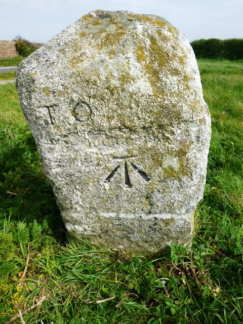
Image: © Rosy Hanns Taken: 17 Apr 2019
Guide Stone by the B3287, in parish of Cuby (Carrick District), near Gargus Farm at junction to Polmassick, on the verge. Inscription defaced:- TO (?) Carved benchmark on South face Cornwall & Scilly HER. HER Number: 177635 https://www.heritagegateway.org.uk/Gateway/Results_Single.aspx?uid=MCO53421&resourceID=1020 Surveyed Milestone Society National ID: CW_XCUBY
Images are licensed for reuse under creativecommons.org/licenses/by-sa/2.0
Image Location
Latitude
50.28641
Longitude
-4.87376