Malthouse Farmhouse, Brandwood End
Introduction
The photograph on this page of Malthouse Farmhouse, Brandwood End by Richard Law as part of the Geograph project.
The Geograph project started in 2005 with the aim of publishing, organising and preserving representative images for every square kilometre of Great Britain, Ireland and the Isle of Man.

There are currently over 7.5m images from over 14,400 individuals and you can help contribute to the project by visiting https://www.geograph.org.uk
Malthouse Farmhouse, Brandwood End
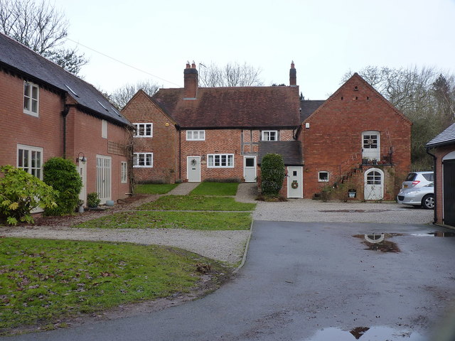
Image: © Richard Law Taken: 16 Dec 2019
Ignoring the new houses on the left, the main buildings in view here are the 16th century Malthouse Farmhouse at the rear, and a slightly more recent barn, now converted, on the right. All were Grade II listed https://britishlistedbuildings.co.uk/101075766-malthouse-farmhouse-brandwood-ward#.XkOtsTH7RPY https://historicengland.org.uk/listing/the-list/list-entry/1075766 in 1982.
Images are licensed for reuse under creativecommons.org/licenses/by-sa/2.0
Image Location
Latitude
52.417376
Longitude
-1.889446